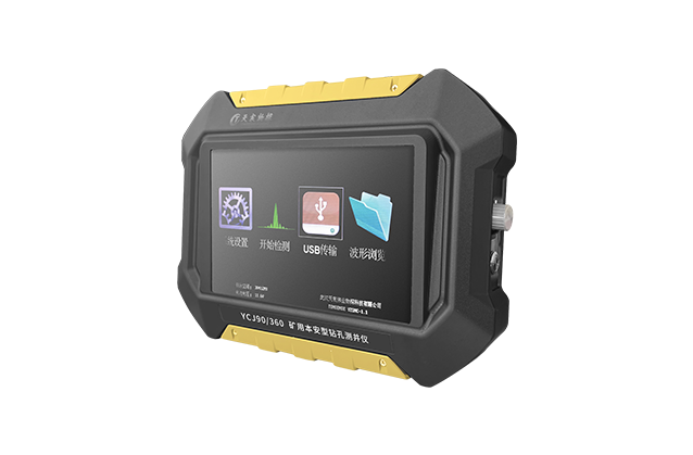
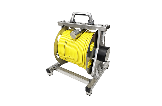
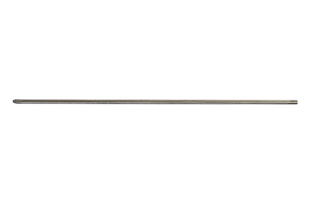
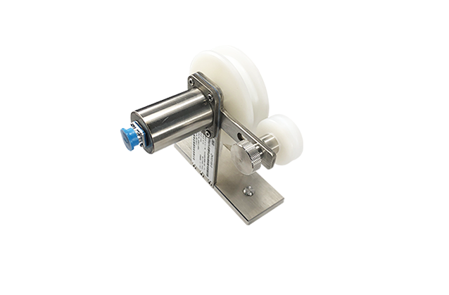
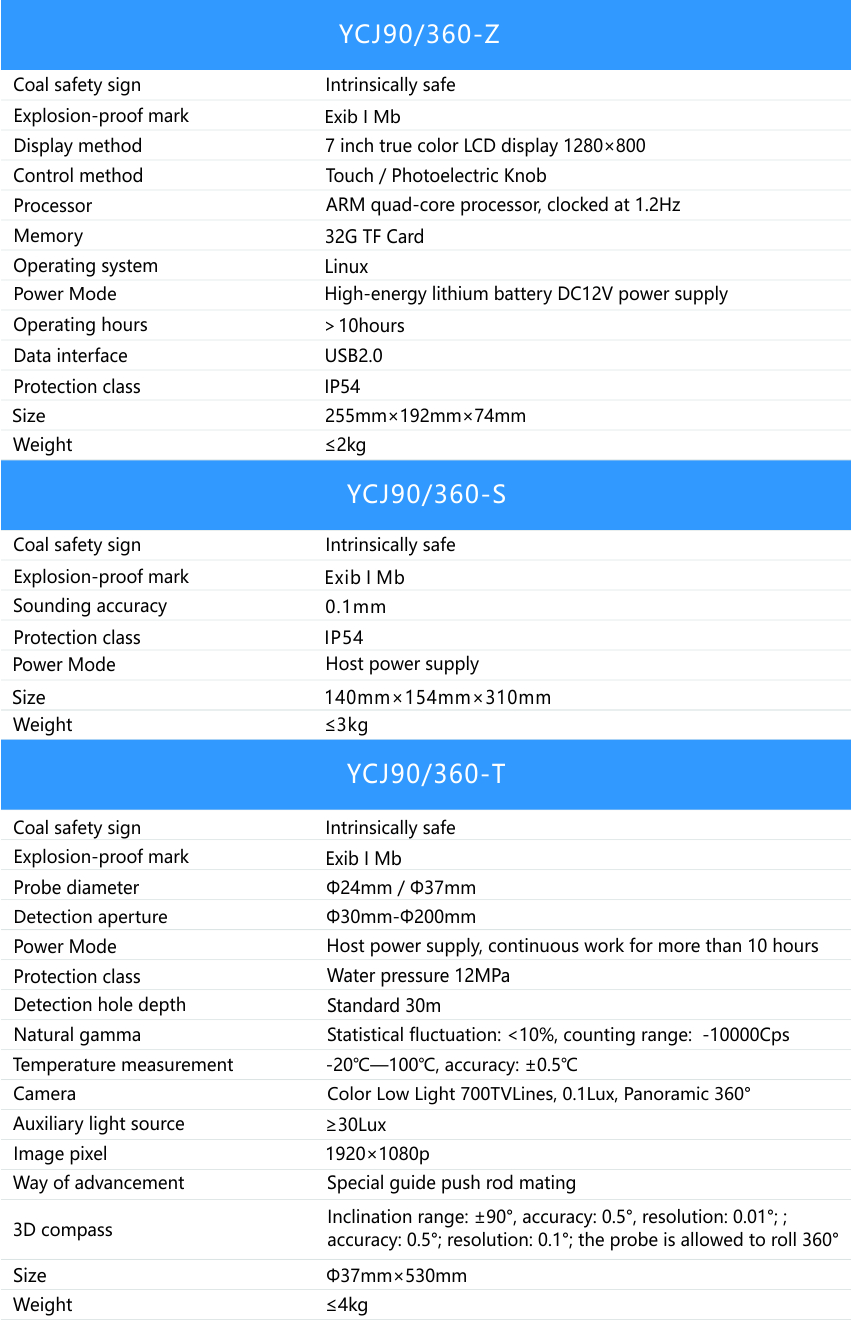
YCJ90/360 Mine Borehole Logger


    The Mine Borehole Logger is an integrated multi-parameter device used to detect the intensity of natural gamma rays, borehole temperature, space trajectory, HD panoramic imaging of borehole wall, dynamic peephole recording and other parameters. It can accurately determine the type and integrity of surrounding rock, evaluate the range of surrounding rock support, position water inrush and gas emission, and guide the design of roof-to-floor surrounding rock support scheme and the prevention of water and gas issues.

  • Gamma ray intensity
  • Drilling temperature
  • Space trajectory
  • HD panoramic imaging
  • Dynamic Peep Video
  • Advantage
  • Details
  • Performance
  • configuration
1

Multifunctional, highly integrated, real-time viewing downhole


Real-time synchronous realization of full-hole wall imaging and video recording of boreholes, snapshot pictures of key parts, borehole trajectory measurement, natural gamma ray measurement, and hole wall temperature measurement.


2

Self developed high integration and high performance motherboard


Realize full hole continuous imaging of kilometer boreholes.
The image is clear and the splicing speed is not lower than 2m/min.

3

Powerful image analysis software


Full hole wall development map - gamma curve - hole wall temperature curve - geological histogram are presented on the same screen, and the drilling trajectory is a 3D map.

Main applicatio 

  • Temperature of the borehole surrounding rock;
  • Intensity of natural gamma rays of the borehole surrounding rock;
  • Borehole space trajectory (azimuth angle, tilt angle and depth) and deviation distance from the design trajectory;
  • HD panoramic expansion, splicing and imaging, dynamic video recording and key part snapshot capturing of the borehole wall.

Advantage  

  • Intensity of natural gamma rays;
  • Borehole temperature;
  • Space trajectory;
  • HD panoramic imaging of borehole wall;
  • Dynamic peephole recording.

Technical feature 

  • Multifunctionality: the multi-function device can be used for full hole wall imaging and video recording, key part snapshot capturing, borehole trajectory measurement, natural gamma ray measurement and hole wall temperature measurement in real time simultaneously; the combination of gamma-ray, hole wall temperature, video image and other parameters delivers more accurate and reliable determination of the type of surrounding rocks;
  • High integration: the system control, image collection, display and storage of the instrument are highly integrated.
  • High intelligence: the 1.2GHz ARM four-core high-speed processor in the instrument has an image processing speed of 30 frames/second. The image data, depth data, probe angle data, natural gamma ray and temperature data can be acquired simultaneously; real-time automatic panoramic image acquisition and rapid seamless connection can be ensured, and automatic angle and depth correction can be realized to present the HD and vivid panoramic videos and images in real time; borehole imaging plane expansion diagrams can be generated underground in real time, and video files in h264 format can also be generated; the dynamic borehole peep diagrams and plane expansion diagrams can be played back underground in real time; image stitching, video recording, snapshot and trajectory measurement, natural gamma ray measurement and temperature measurement can be conducted in real time simultaneously;
  • High reliability: the machine system is highly integrated and stable; the airtight machine also offers good waterproofness and dustproofness;
  • High definition: the camera presents a low color illumination of 700Lines, 0.01Lux, 20 million pixels; the light intensity can be continuously adjusted;
  • Wide angle of view: the camera has a wide angle of view and can achieve horizontal 360-degree panoramic imaging without focusing;
  • Good portability: the compact and lightweight machine is portable;
  • Good operability: the easily connected and easy to operate system allows the beginners to master its operations quickly; the instrument can be used as an external USB of the computer, and the data can be copied and pasted directly;
  • Low power consumption: the operating voltage of the system is DC12V. The system built in with high-capacity lithium battery can work continuously for no less than 10 hours.
  • Automatic probe flushing: the probe is designed with a center guide device, and a probe window flushing function;
  • Powerful analysis software: full hole wall expansion diagram—Gamma curve—hole wall temperature curve—geologic column can be displayed on the same screen; 3D borehole trajectory diagram, three-side view and offset distance can be displayed intuitively; 3D virtual rock core can be viewed at any angle of view, vivid and intuitive; the report can be generated in such format files as JPG, BMP, PDF and WORD;
  • Direct rock core description: the rock core can be directly described on the expansion diagram, and the fracture inclination, tilt angle and width can be automatically calculated and extracted directly; the width accuracy can reach 0.1mm, and the azimuth angle can reach 0.1o;
  • Strong bearing capacity of the probe: the probe has a stainless steel housing, and a tempered optical glass probe cover, able to withstand a maximum pressure of no less than 20MPa.
  • The optimal real-time synchronous detection rate of imaging, recording and trajectory is about 2m/min, up to 0.2m/s.


--- Links ---

Address:Building 10, Fenghuang Industrial Park, No.52, Liufang Road, East Lake High-tech Development Zone,Wuhan

Sales:13545388336

After-sales:027-87921088

Maintenance:18627061330

QQ:2765677062

Copyright © 2024 Wuhan Tensense Geotech Prospecting Technology Co., Ltd.. All Rights Reserved 鄂ICP备13006517号-1