
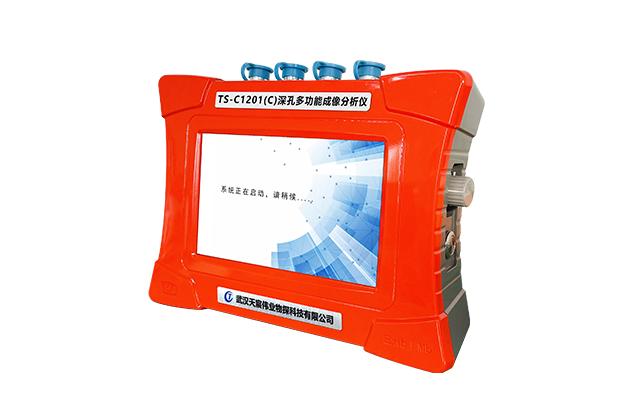

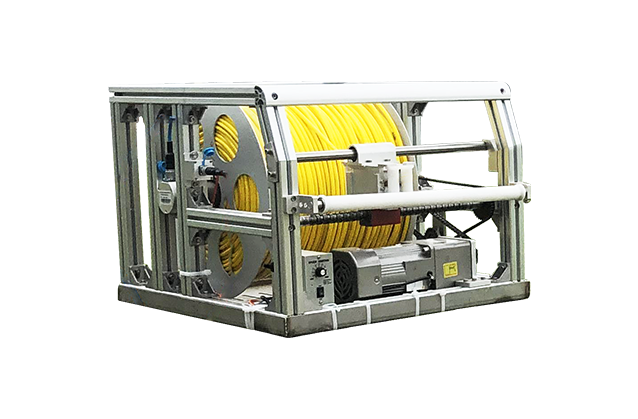


TS-C1201(C)Multi-function Borehole Imaging Analyzer
TS-C1201(C)Multi-function Borehole Imaging Analyzer.Omni-directional borehole inspection equipment integrated with borehole imaging, borehole recording (peering), and borehole trajectory detection which is exclusively launched at home.
-
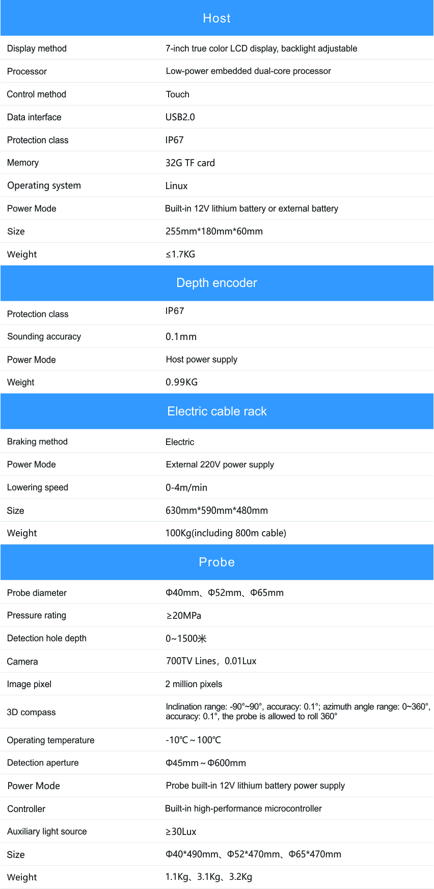
 Full function
 -
 Test hole depth 1500m
 -
 1080p HD imaging
 -
 Powerful software
- Advantage
- Details
- Performance
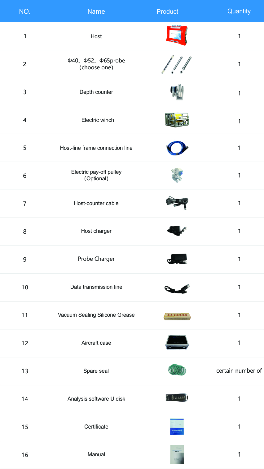
- configuration
--- Links ---
Address:Building 10, Fenghuang Industrial Park, No.52, Liufang Road, East Lake High-tech Development Zone,Wuhan
Sales:13545388336
After-sales:027-87921088
Maintenance:18627061330
QQ:2765677062
-
Products
-
Technical Center
-
Service
-
News Center
-
About Us
-
Contact Us

Copyright © 2026 Wuhan Tensense Geotech Prospecting Technology Co., Ltd.. All Rights Reserved 鄂ICP备13006517号-1